Operational flight plan
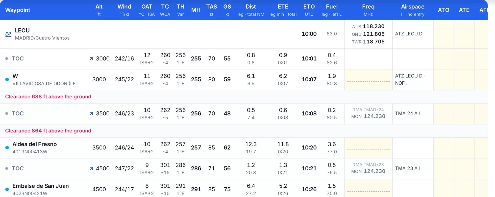
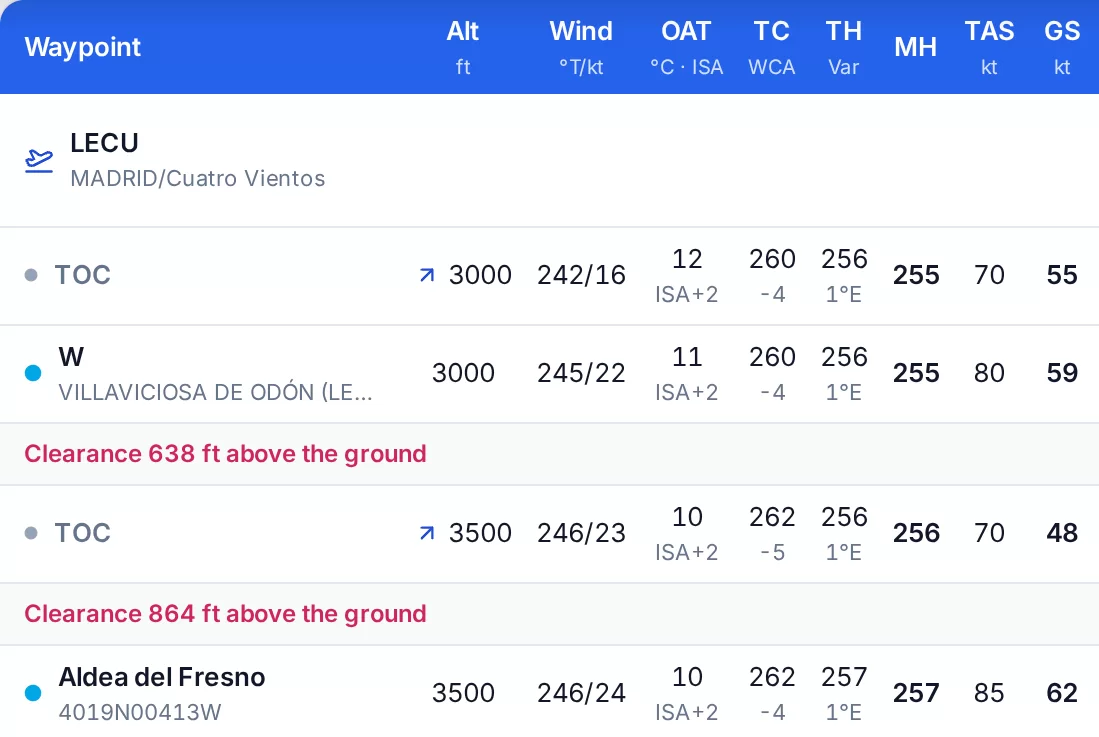
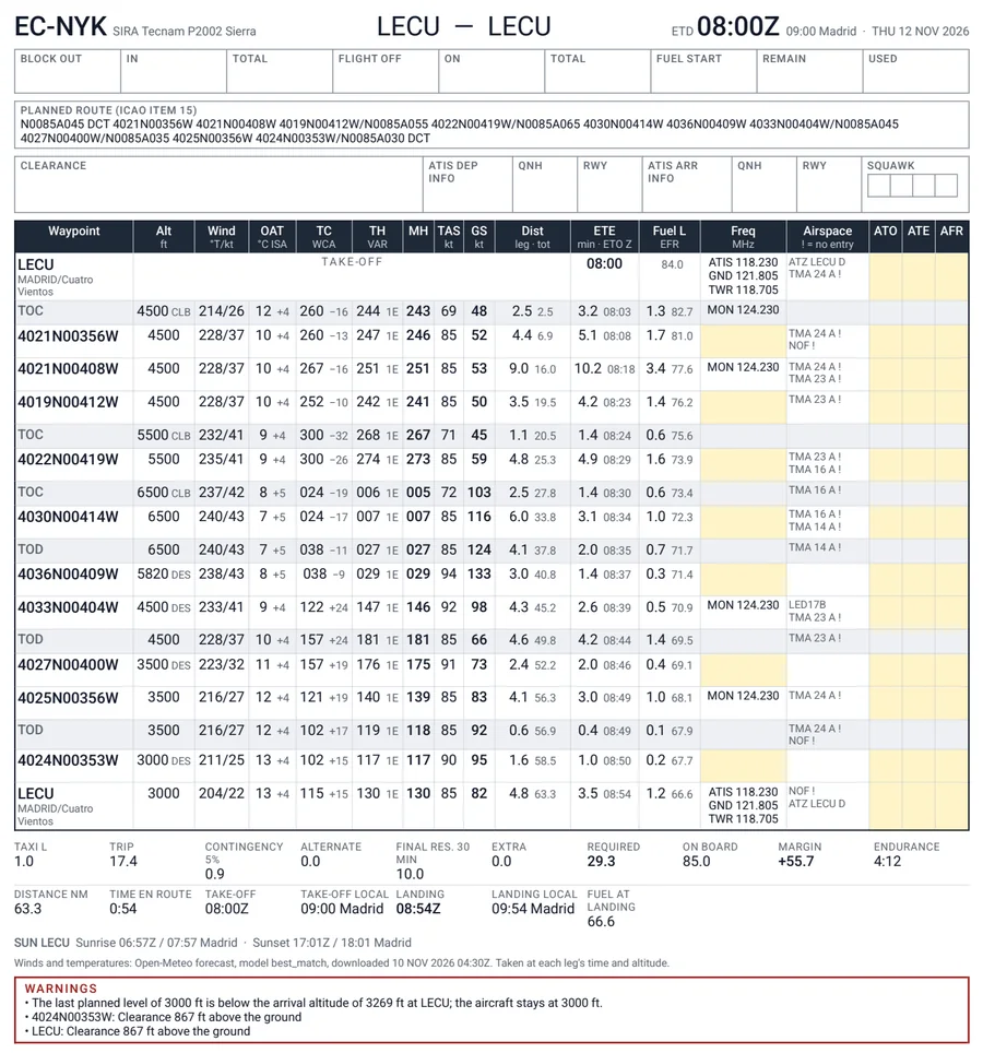
The standard operational flight plan columns for every leg, from wind and OAT to ETO and fuel left, with top of climb and descent, clearance warnings, and blank ATO, ATE and AFR columns to fill in flight.
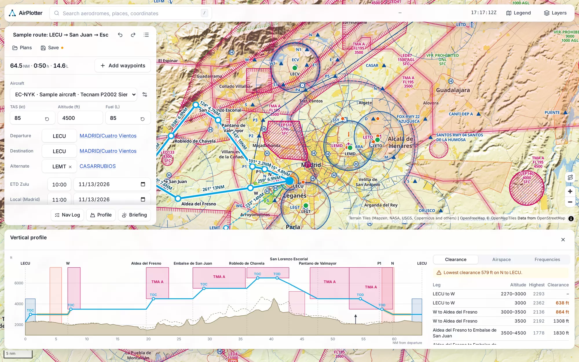
VFR flight planning for Spain. Draw your route on an aeronautical map built from official ENAIRE data, and get the nav log, fuel and terrain clearance worked out from real forecast winds.
How it works
Six steps, one tool. Every number comes from official data or the forecast for your departure time.
01
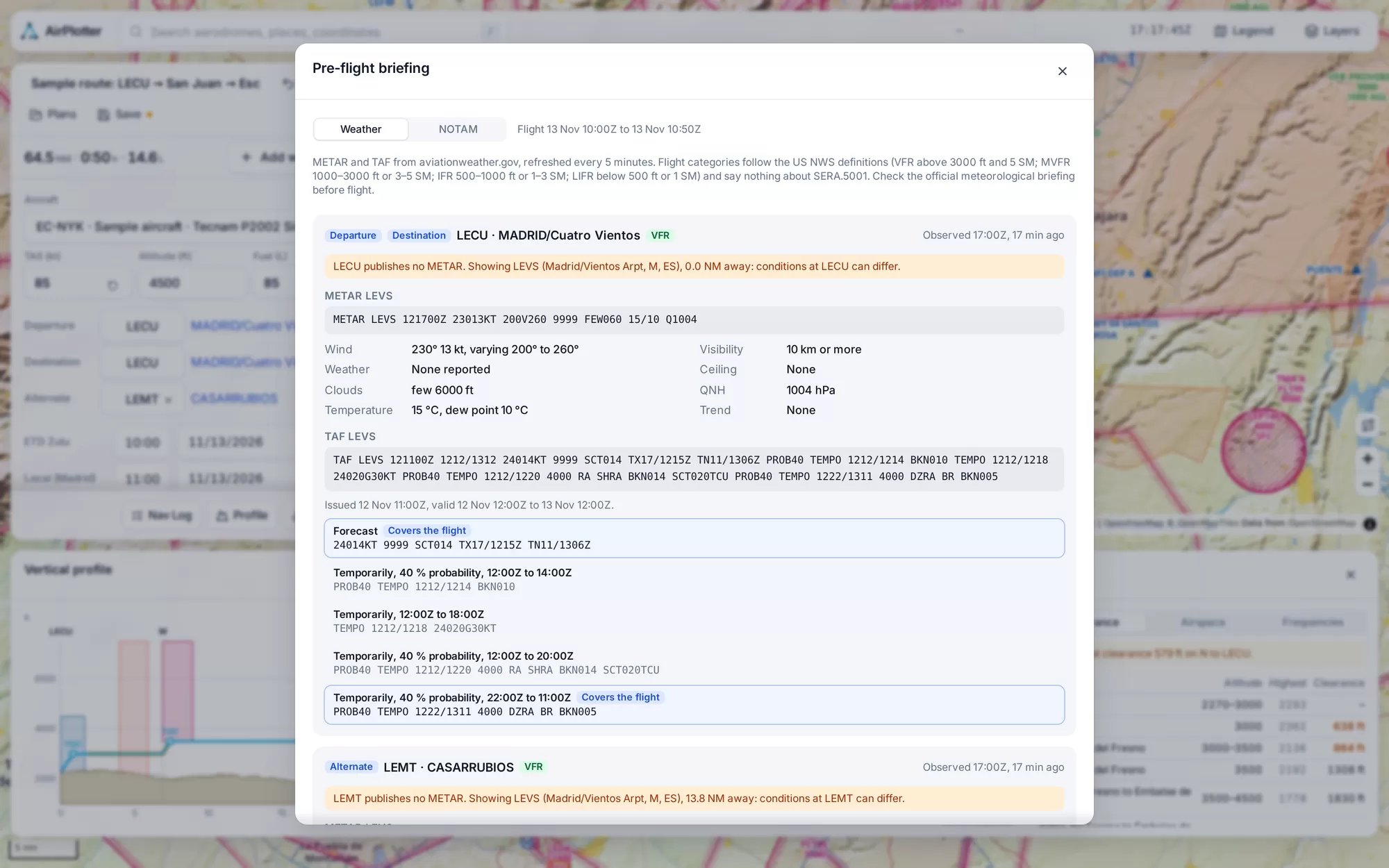
Click anywhere on the map, or search a place, an aerodrome or a reporting point. Type a route string if you prefer. Your route can run through any point you choose, and you see every ENAIRE airspace, navaid and obstacle on the way.
02
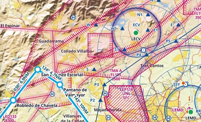
AirPlotter fetches the forecast winds aloft for your departure time and works out the wind correction, heading and ground speed for every leg, climb and descent included.
03
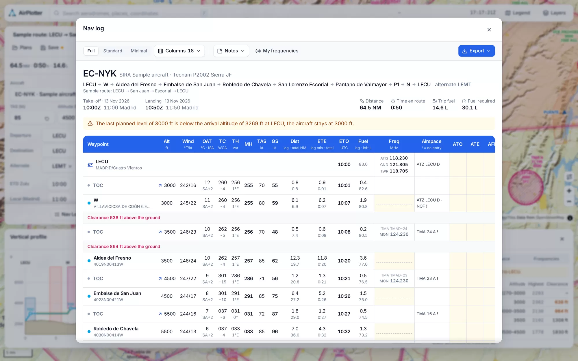
A full nav log for every leg: altitude, wind, OAT, true and magnetic course and heading, TAS and GS, distance, time, ETO and fuel left. Top of climb and descent are placed for you, low terrain clearance is flagged on the leg, and the frequencies and airspaces sit on each row. Pick Full, Standard or Minimal columns, and fill in ATO, ATE and fuel in flight.
04
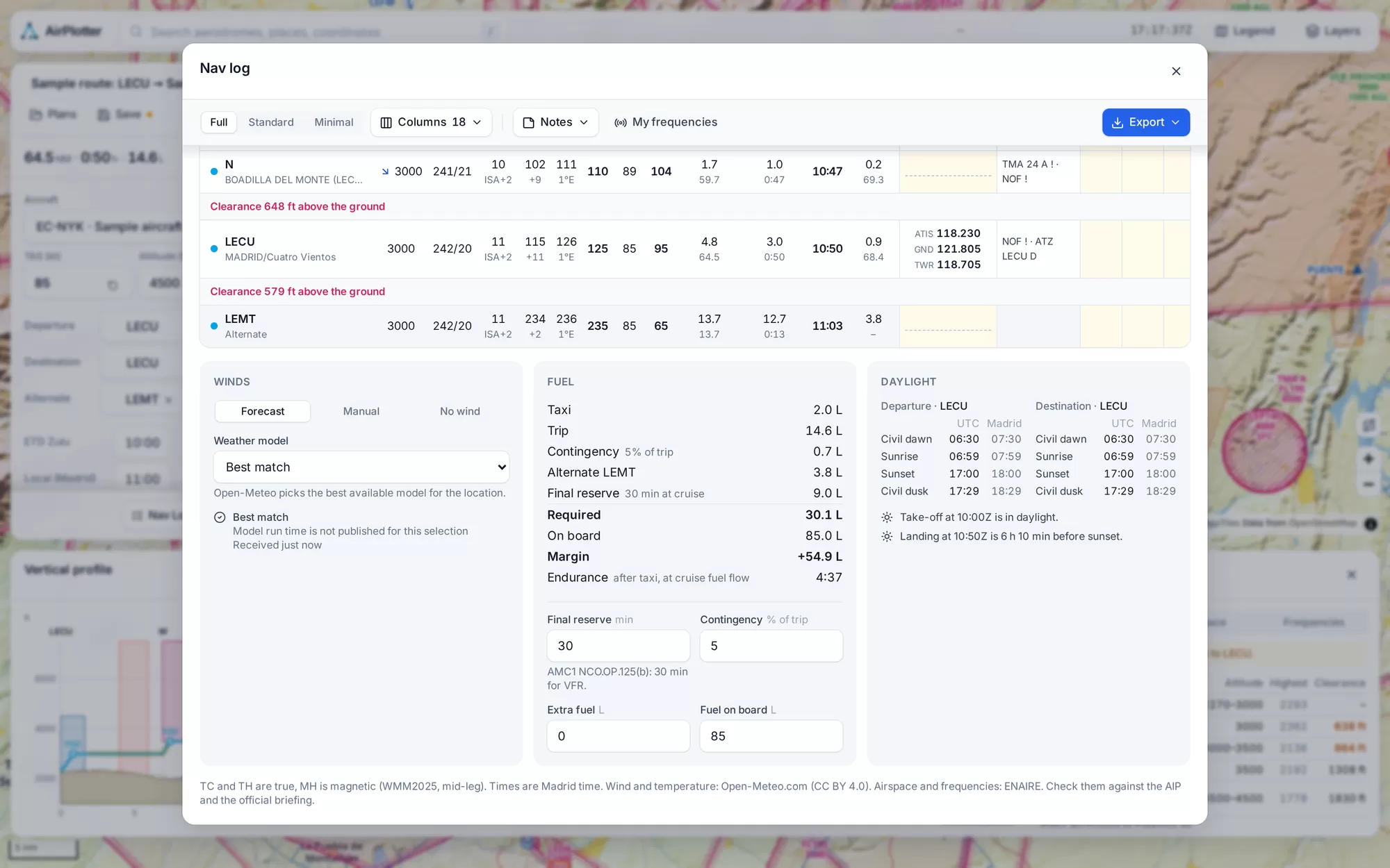
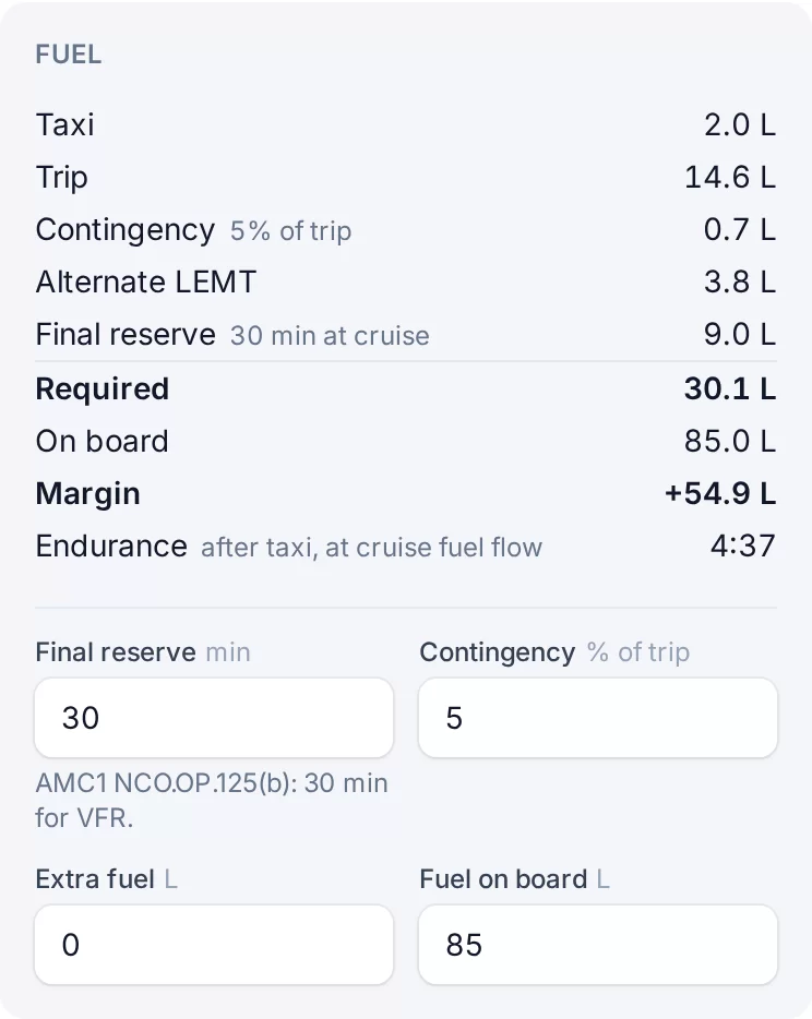
Taxi, trip, contingency, alternate and final reserve add up to the fuel you need, set against what is on board, with the endurance that leaves you.
05
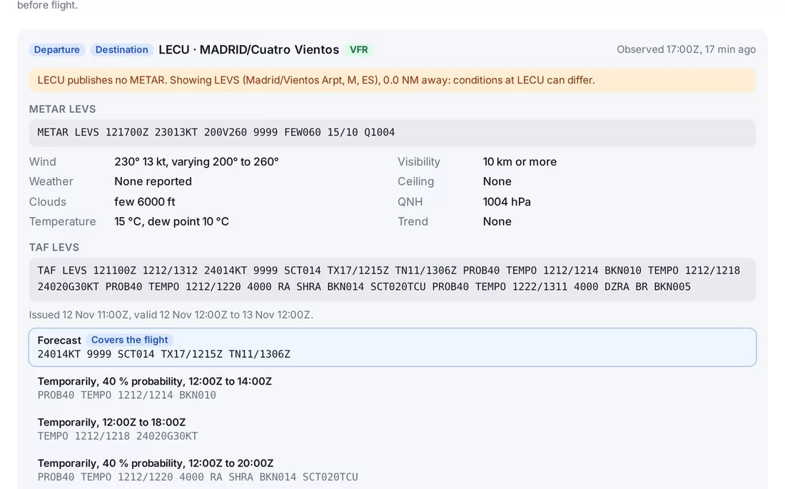
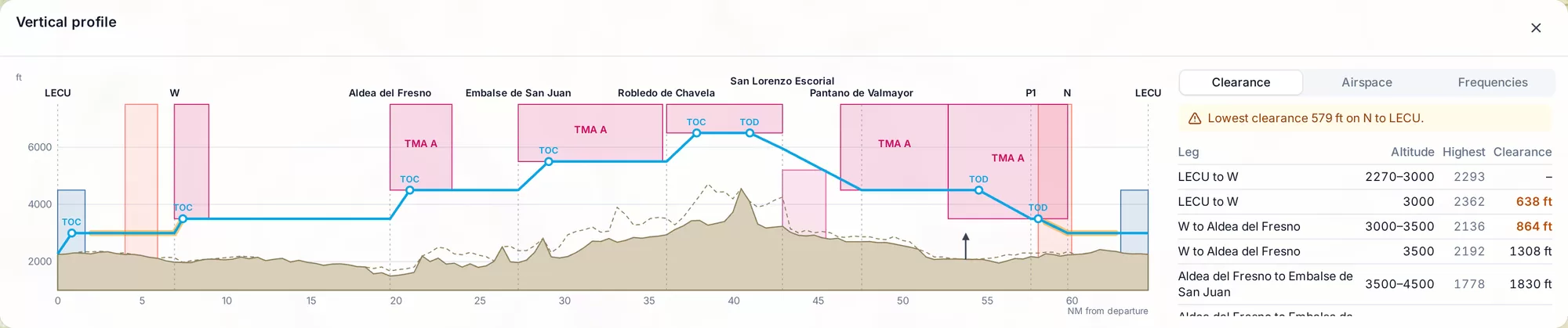
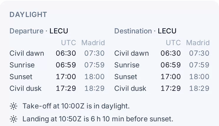
Terrain clearance and the airspaces you cross, leg by leg, with the frequencies to call, live NOTAMs, METAR and TAF, and sunrise and sunset at both ends.
06
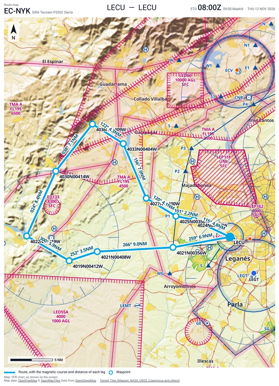
Print the nav log with its route map page, or the map alone for the kneeboard. Load the route in your GPS or EFB, and prepare the ICAO flight plan.
More than a map
The chart is where you start. The detail is in the plan: every leg worked out from the forecast, with the frequencies, the airspaces and the names you use in the cockpit.
The standard operational flight plan columns for every leg, from wind and OAT to ETO and fuel left, with top of climb and descent, clearance warnings, and blank ATO, ATE and AFR columns to fill in flight.
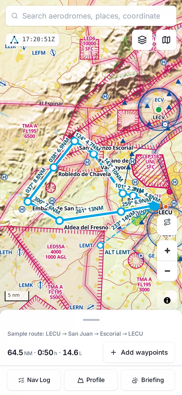
The same planner with a bottom sheet over the map. Check the plan on the ramp.
The published VFR reporting points and VFR routes, ready to click into your route, with the airspaces and zones, aerodromes, navaids and obstacles around them.
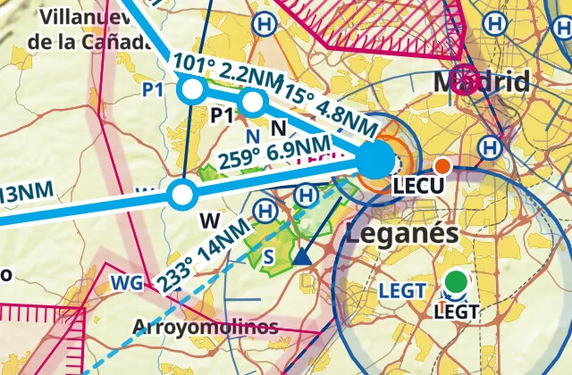
Forecast wind and temperature at your level for the time you fly each leg, with the wind correction and ground speed that follow. Or enter your own wind.
The ones to call first, then the ones to monitor, exactly as published. Add your own to the list.
ATIS 118.230 · TWR 118.705 · MON 124.230
Call a point what you call it on the radio. The name shows in the list, the nav log and the PDF.
4019N00413W → Aldea del Fresno
Each row lists the airspaces you fly through and marks the ones you may not enter.
Terrain, airspace floors and ceilings, and your climb and descent along the route, with the lowest clearance flagged.
Taxi, trip, contingency, alternate and final reserve, against fuel on board, with the endurance left.
Civil dawn, sunrise, sunset and civil dusk at both ends, with a warning when you land after dark.
Nav log PDF with a route map page, route map PDF, GPX, Garmin FPL and the ICAO flight plan.
Speeds, climb and descent rates and fuel flows saved once, reused on every plan.
ENAIRE NOTAMs, METAR and TAF for the aerodromes near your route.
Questions
A VFR flight planner for Spain. You draw a route on an aeronautical map and get an operational flight plan with wind correction, fuel, frequencies, airspaces and terrain clearance for every leg.
The reporting points, VFR routes, airspaces, aerodromes, navaids and obstacles are ENAIRE's official data, and NOTAMs come from ENAIRE. Forecast winds come from Open-Meteo, and METAR and TAF from aviationweather.gov.
Print the nav log as a PDF, with a route map page, or save the route map as a PDF for the kneeboard. You can also export a GPX file, a Garmin FPL file and the ICAO flight plan.
No. AirPlotter runs in your browser, on a computer or on a phone, where a bottom sheet sits over the map.
Yes, that is what it is made for. Every leg is worked out from official ENAIRE data and the forecast for your departure time, and it sits next to your usual pre-flight routine with the AIP, the NOTAMs and the weather briefing.